Prévaltera 2011: building a decision making process to find agro-ecological solutions suitable for all agricultural actors in a sustainable development perspective
(ASET, IPLB, 2011)
How to reach a consensus between farmers, local authorities and environmental agencies ?
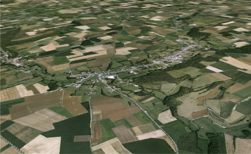
Anvin, Pas-de-Calais, France
It is very complicated, because they all have their own interests and business to defend and they frequently don't see eye to eye because some of their goals are divergent. However in a matter of sustainable development, solutions can and should be adopted by all three.
The area of Anvin (Pas-de-Calais, France) is subject to unprecedented soil erosion (up to 30 cm of soil per year in some places), and accounts for a very poor ecological status due to extensive agriculture. Moreover farms release tons of chemicals into the soil every year, and erosion along with the lack of natural barriers enhance the horizontal transfer of pollutants that ultimately result in a threat for all three parties.
The purpose of this year-long study was to elaborate a decision-making process that generates agro-ecological solutions (AES) at the agricultural plot scale that all three parties benefit from, to tackle erosion and ecological issues, and in which farmers get the final say. In other words, Prevaltera is an automated system that can be used by local authorities and environmental agencies to find acceptable AES that farmers consider and accept to adopt in their own parcels.
A lot of data for 4 criteria:
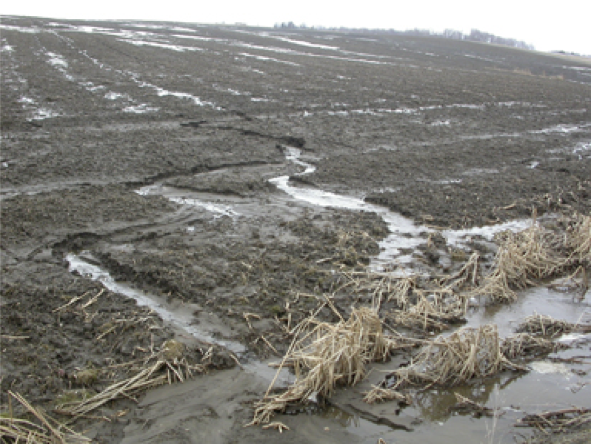
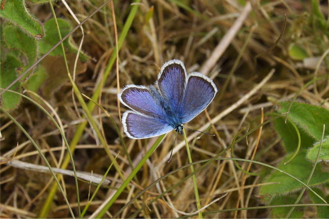
Erosion can literally ruin a crop
Basically, each agricultural parcel of our study area (20,000 plots in total) required information to put in four criteria, all validated by local authorities and environmental agencies:
-the erosion status of the parcel (erosion sensitiveness, quantity of soil lost to erosion, slope, transfer patterns, pedology...)
-the cultural status of the parcel (financial value, crop used, strategic value)
-the ecological status of the parcel (habitat connectivity map, key species found in or on the edge, distance to a remarkable habitat...)
-Miscellaneous status of the parcel (shape, accessibility, legal constraints, distance to communities and woods, azimuth...)
All data consisted of field collections (2 full weeks) and laboratory collection (GIS) and calculations (statistics, math...).
Each parcels received a mark from each criteria, allowing us to select priority ones.
Meanwhile, a list of AES (ex: set up tree hedges, adopt agroforestry, dig ditches, cover in winter, grass bands, no plow...) was built and submitted to local authorities and environmental agencies.
Towards agro-ecological solutions adapted to the parcel
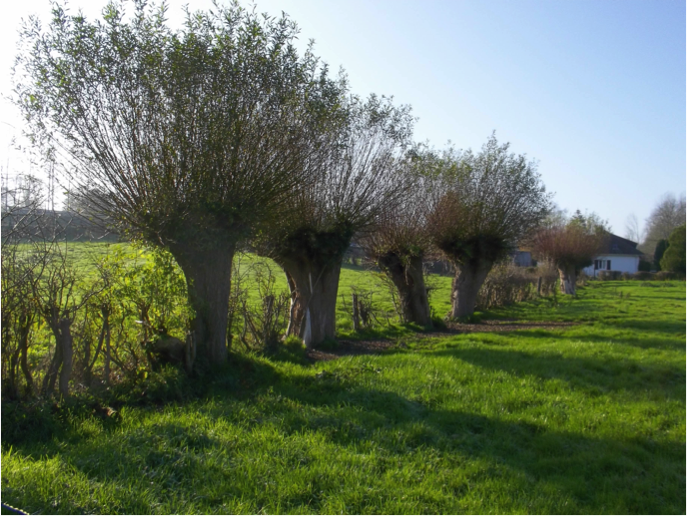
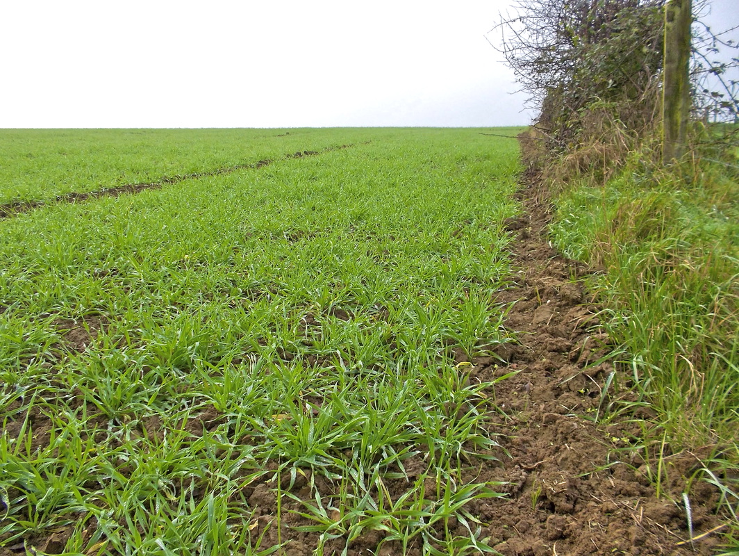
Example of solution to limit erosion and promote ecological corridors: a hedge
The survey aimed to find parcels with an alarming status (either ecological or erosion) and attribute them AES. However these solutions have to take into account not only the erosion and ecological status, but also the two other ones (for example, if the parcel has a complicated shape, farmers usually won't accept to grow a tree hedge because it requires a lot of maintenance, time and loss of income).
This is why the group decided that the 4 criteria should weigh different ponderation according to farmers will, but also to find a consensus:
-Erosion status: 41,8%
-Ecological status: 25,9%
-cultural status: 21,2%
-Miscellaneous: 11,9%
Each AES was also given a relevancy mark according to the criteria so that everything is linked. The result of this system is that each parcel obtains, according to its average criteria mark, a list of AES ranked from the most adapted one to the less adapted one.
Farmers get the last call !
However finding AES adapted to the parcel is one thing, and making farmers even consider them is another story. Indeed farmers are the legal owners of their land where solutions would be implemented. Consequently they should get the final decision, particularly as they would pay (partly by way of subsidies from local authorities) for setting up these solutions. This is why our system ultimately incorporated (thanks to a door-to-door survey) farmers' opinion (would they consider or even accept these solutions).
Though it is to be borne in mind that the result of the study is a simple survey, and no one will have to accept any solution (at least not right away). It just gives an idea of priority parcels to work on and what are the most accepted AES to be suggested.
Though it is to be borne in mind that the result of the study is a simple survey, and no one will have to accept any solution (at least not right away). It just gives an idea of priority parcels to work on and what are the most accepted AES to be suggested.
Towards a replicable method: a semi-computerized decision-making process
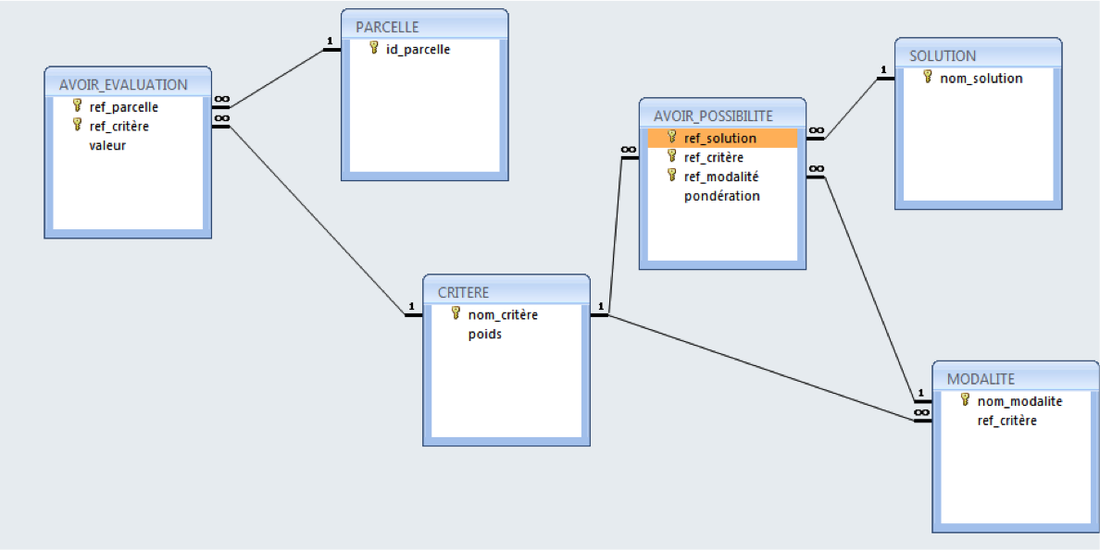
Now you may wonder: Did we do all that for all 20,000 parcels in our study area ? Of course not! Even being a 20-person group wouldn't cut it to cover every parcel. As a result, we needed a computerized program able to input all data and thanks to an algorithm, produce the expected result.
I personally designed the algorithm from MS Excel to MS access (database) to output a ranked list of AES adapted for each parcel, taking all marks and ponderations into account.
Some data still need to be collected by hand (farmer surveys, field confirmation...)
I personally designed the algorithm from MS Excel to MS access (database) to output a ranked list of AES adapted for each parcel, taking all marks and ponderations into account.
Some data still need to be collected by hand (farmer surveys, field confirmation...)
Final results and conclusion
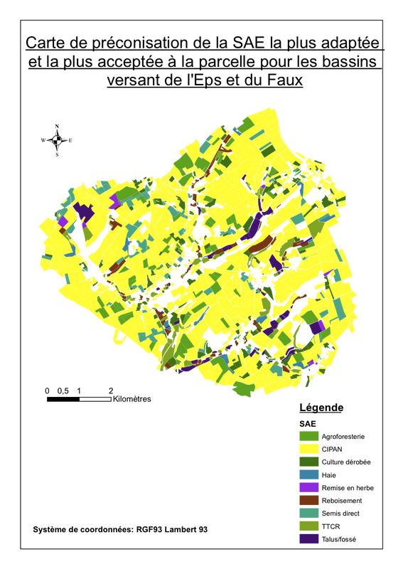
We were able to input all results from the decision-making process from MS Access to ArcGIS (GIS software) to get a map of the most adapted and accepted AES per parcel in the study area.
It shows that the most accepted and adapted AES in most cases was nitrate-trap crops (cover crop) which are easy to set up, economically affordable for most farmers, and are well established in local habits. Some farmers are also ready to accept transforming some of their parcels into agroforestry, which dramatically prevents erosion and tremendously improves the ecological networking, and can give a substantial source of revenue for farmers.
Conversely farmers did not seem ready to accept hedges or reforestation, mainly because they consider it as a loss of space and thus income. They usually don't measure the impact of what a simple bush or tree hedge can do for their parcels and usually make up for the loss of revenue: recent literature showed that it not only significantly reduces erosion of fertile soil / transfer of poisonous chemical, but it also supports habitat and passage ways for many animal and plant species. For example, it has been shown that foxes and hawks live in tree hedges but forage in adjacent fields, eliminating rodents from their burrows. It results in decreasing the loss of crop by these small mammals, and it also favors many pollinator species (bumblebees, bees, wasps...) to lodge in the abandoned holes, and thus unknowingly increases crop yields.
This study underscores that many solutions can be found at the parcel scale respecting a consensus. Nonetheless farmers are the key to adopting these solutions and the present survey demonstrated that habits die hard. Innovative solutions are barely considered when pronounced, and even 'good old' solutions such as hedges are very difficult to accept, mainly because of the hedge-lifting campaign that occurred after World War II in France.
Change is hard to accept for everybody, and this work points out that it can only be done while informing local populations and farmers about the long-term benefits that agro-ecological solutions can indirectly bring to the table.